
Learning Objectives
Reproject remotely sensed data (change CRS)
Reproject on-the-fly
Compare resampling options
Remote Sensing Coordinate Reference Systems#
Image projections can be transformed in GeoWombat using the configuration manager (see Config Manager). With the configuration manager, the CRS is transformed using rasterio CRS and virtual warping. For references, see Spatial Reference and epsg.io.
View Image Coordinate Reference System & Properties#
In the following we will print out the properties relevant to CRS for the red, green blue image. The CRS can be accessed from the xarray.DataArray attributes.
import geowombat as gw
from geowombat.data import rgbn

with gw.open(rgbn) as src:
    print(src.transform)
    print(src.gw.transform)
    print(src.crs)
    print(src.resampling)
    print(src.res)
    print(src.gw.cellx, src.gw.celly)
(5.0, 0.0, 792988.0, 0.0, -5.0, 2050382.0)
(5.0, 0.0, 792988.0, 0.0, -5.0, 2050382.0)
32618
nearest
(5.0, 5.0)
5.0 5.0
Transforming a CRS (Reprojection)#
To transform the CRS, use the context manager. In this example, a proj4 code is used. See understanding CRS codes for more details. We can pass the desired CRS as a proj4 string, an EPSG code, or in authority:code EPSG:4326 or ESRI:53018.
Note
Note the use of nodata in this case the file rgbn doesn’t have the missing data value set in its profile, so we can set it manually when opened.
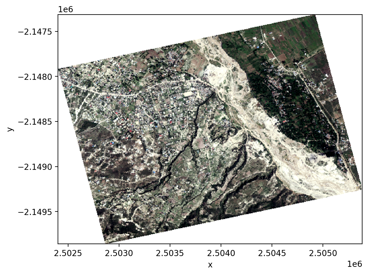
import matplotlib.pyplot as plt

fig, ax = plt.subplots(dpi=200)

proj4 = "+proj=aea +lat_1=20 +lat_2=60 +lat_0=40 +lon_0=-96 +x_0=0 +y_0=0 +datum=NAD83 +units=m +no_defs"

with gw.config.update(ref_crs=proj4):
    with gw.open(rgbn, nodata=0) as src:
        # replace 0 with nan
        src = src.gw.mask_nodata()
        print(src.transform)
        print(src.crs)
        print(src.resampling)
        print(src.res)
        src.sel(band=[3,2,1]).plot.imshow(robust=True, ax=ax)

plt.tight_layout(pad=1)
(5.0, 0.0, 2502400.7632678417, 0.0, -5.0, -2147313.7330151177)
+proj=aea +lat_0=40 +lon_0=-96 +lat_1=20 +lat_2=60 +x_0=0 +y_0=0 +datum=NAD83 +units=m +no_defs +type=crs
nearest
(5.0, 5.0)
Other formats supported by rasterio, (e.g., PROJ4 strings) can be used. Here, we use a PROJ4 string to transform the CRS to a equal area projection.
with gw.config.update(ref_crs=32618):
    with gw.open(rgbn) as src:
        print(src.transform)
        print(src.crs)
        print(src.resampling)
        print(src.res)
(5.0, 0.0, 792988.0, 0.0, -5.0, 2050382.0)
32618
nearest
(5.0, 5.0)
Resampling the Cell Size#
Resampling cell size refers to the process of changing the spatial resolution of raster data. This can be done by either increasing or decreasing the size of the grid cells that make up the raster. There are different methods for resampling:
nearest: Uses the value of the closest cell to assign a value to the output cell.bilinear: Uses the weighted average of the four nearest cells to determine the output cell value.cubic: Uses the weighted average of 16 nearest cells to determine the output value.
The resampling algorithm can be specified in the geowombat.open function. Here, we use cubic convolution resampling to warp the data to EPSG code 31972 (a UTM projection).
with gw.config.update(ref_crs=31972):
    with gw.open(rgbn, resampling='cubic') as src:
        print(src.transform)
        print(src.crs)
        print(src.resampling)
        print(src.res)
(5.0, 0.0, 792988.0000004865, 0.0, -5.0, 2050381.9999358936)
31972
cubic
(5.0, 5.0)
The transformed cell resolution can be added in the context manager. Here, we resample the data to 10m x 10m spatial resolution.
with gw.config.update(ref_crs=31972, ref_res=(10, 10)):
    with gw.open(rgbn, resampling='cubic') as src:
        print(src.transform)
        print(src.crs)
        print(src.resampling)
        print(src.res)
(10.0, 0.0, 792988.0000004865, 0.0, -10.0, 2050381.9999358936)
31972
cubic
(10.0, 10.0)
Transformations Outside Context Manager#
To transform an xarray.DataArray outside of a configuration context, use the geowombat.transform_crs function.
with gw.open(rgbn) as src:

    src_tr = src.gw.transform_crs(proj4, dst_res=(10, 10), resampling='bilinear')
    print(src_tr.transform)
    print(src_tr.crs)
    print(src_tr.resampling)
    print(src_tr.res)
(10.0, 0.0, 2502400.7632678417, 0.0, -10.0, -2147313.7330151177)
+proj=aea +lat_1=20 +lat_2=60 +lat_0=40 +lon_0=-96 +x_0=0 +y_0=0 +datum=NAD83 +units=m +no_defs +type=crs
bilinear
(10, 10)